Products
Comprehensive operational picture combining multiple data sources on a single platform.
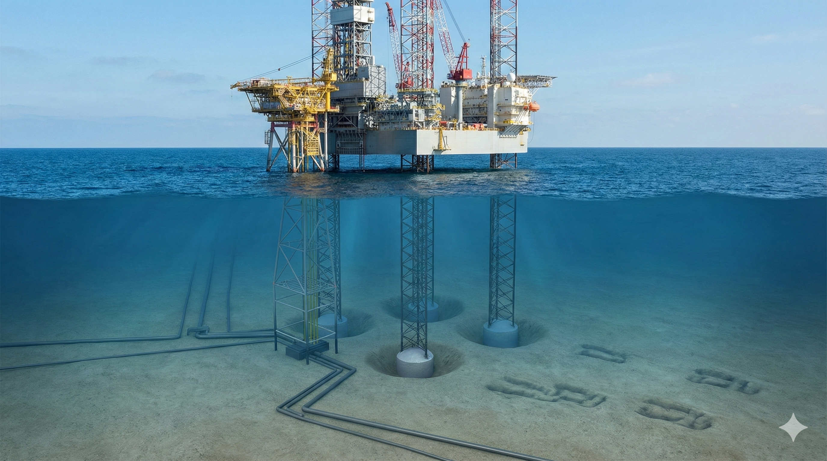
E&P companies spend millions on seabed surveys to acquire data for activities such as determining well locations, rig and anchor placement, identifying geophysical hazards, and selecting pipeline routes — yet often have no means of viewing their offshore assets spatially in an easy-to-use, interactive mapping system shared across the organization. The Seabed Assurance System solves this by consolidating survey data, vessel positions, weather feeds, and asset records into a centralized spatial database, giving operators, engineers, and managers the complete picture they need to plan safely and make confident decisions.
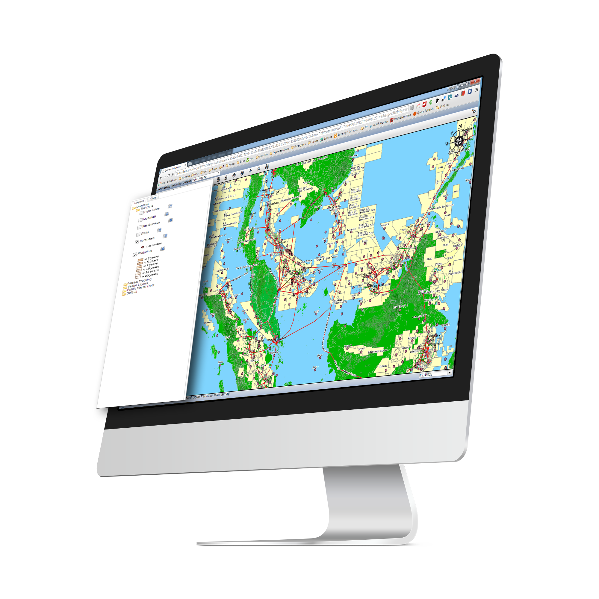
Web Based GIS Platform
SAS provides a web based GIS interface that displays your entire area of operations on a single screen. View vessel routes, pipeline networks, platform locations, and offshore assets overlaid on nautical charts. Layer controls let each team customize their view, while the browser based architecture means access from any device, anywhere.
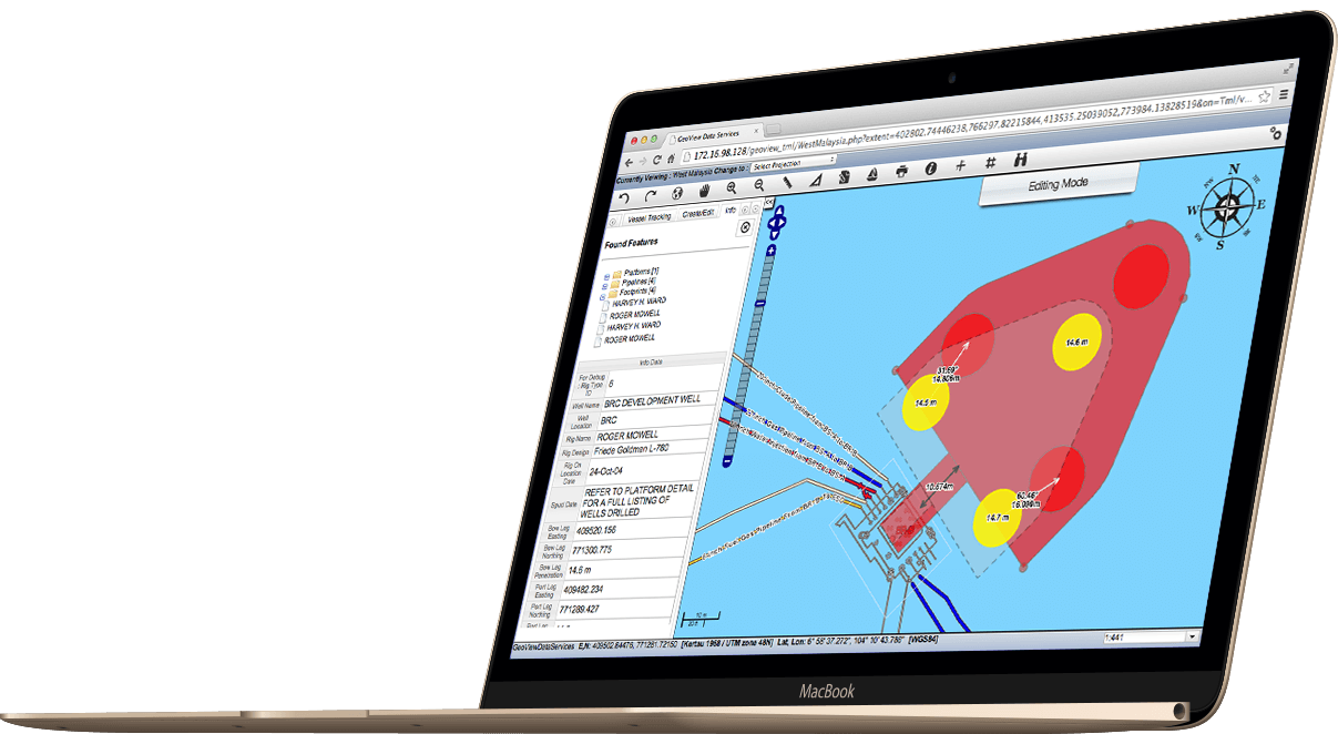
Rig Positioning & Planning
Carefully plan and monitor anchoring operations, quickly assess jack-up rig suitability, and avoid costly leg and platform damage. Place to-scale rigs, barges, and vessels on the map, then move and rotate them with the mouse or numerically. Measure real distances and bearings to sub-sea assets, compare proposed leg positions with existing footprints, and use the drilling envelope visualization to determine rig suitability at a specific platform. SAS automatically calculates the coordinates of each leg to ensure coring is done at the exact proposed position.
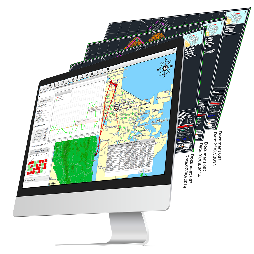
Document Management
The integrated Document Management System links survey reports, as built drawings, seabed charts, and operational documents directly to their spatial location on the map. Click any asset or location to instantly access every related document. No more searching through folders or asking colleagues where the data lives.
Capabilities
Consolidate vessel data, weather, assets, pipelines, and safety zones onto a single interactive map.
Real time weather overlays for wind, waves, and current conditions directly on the operational map.
Define and monitor exclusion zones with automated alerts when vessels approach restricted areas.
Configurable notifications for zone breaches, weather thresholds, and operational events.
Tailored views and permissions for drilling, marine, management, and HSE teams.
Our team converts your as built and survey data into spatial format and maintains it as your field expands.
Place and rotate to-scale rigs, barges, and vessels on the map with mouse or numerical positioning.
Compare proposed jack-up leg positions with existing footprints and automatically calculate coring coordinates.
All as-built assets — pipelines, platforms, wells, boreholes, and survey data — in one shared database.
See how GDS can deliver real-time intelligence, improve safety, and reduce costs across your fleet.