Menu

Products

FIS (Fleet Information System)

Real time vessel tracking with AIS integration and fleet wide awareness.

Complete fleet visibility, from bridge to boardroom

The Fleet Information System uses state-of-the-art navigation technologies (GDS-GPS) designed and built by GDS Hardware in collaboration with the GDS marine department to get frequent position, weather, and fuel sounding reports. Combined with live AIS data and proprietary analytics, FIS gives you real time visibility over every vessel in your area of operations — from daily activity and fuel consumption monitoring to crew reports, maintenance records, deck space utilization, and charter party compliance verification.


FIS fleet tracking interface showing live vessel positions and details

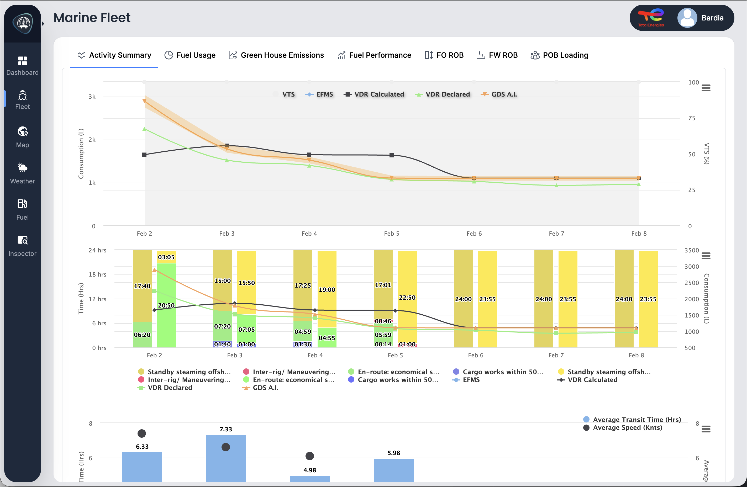
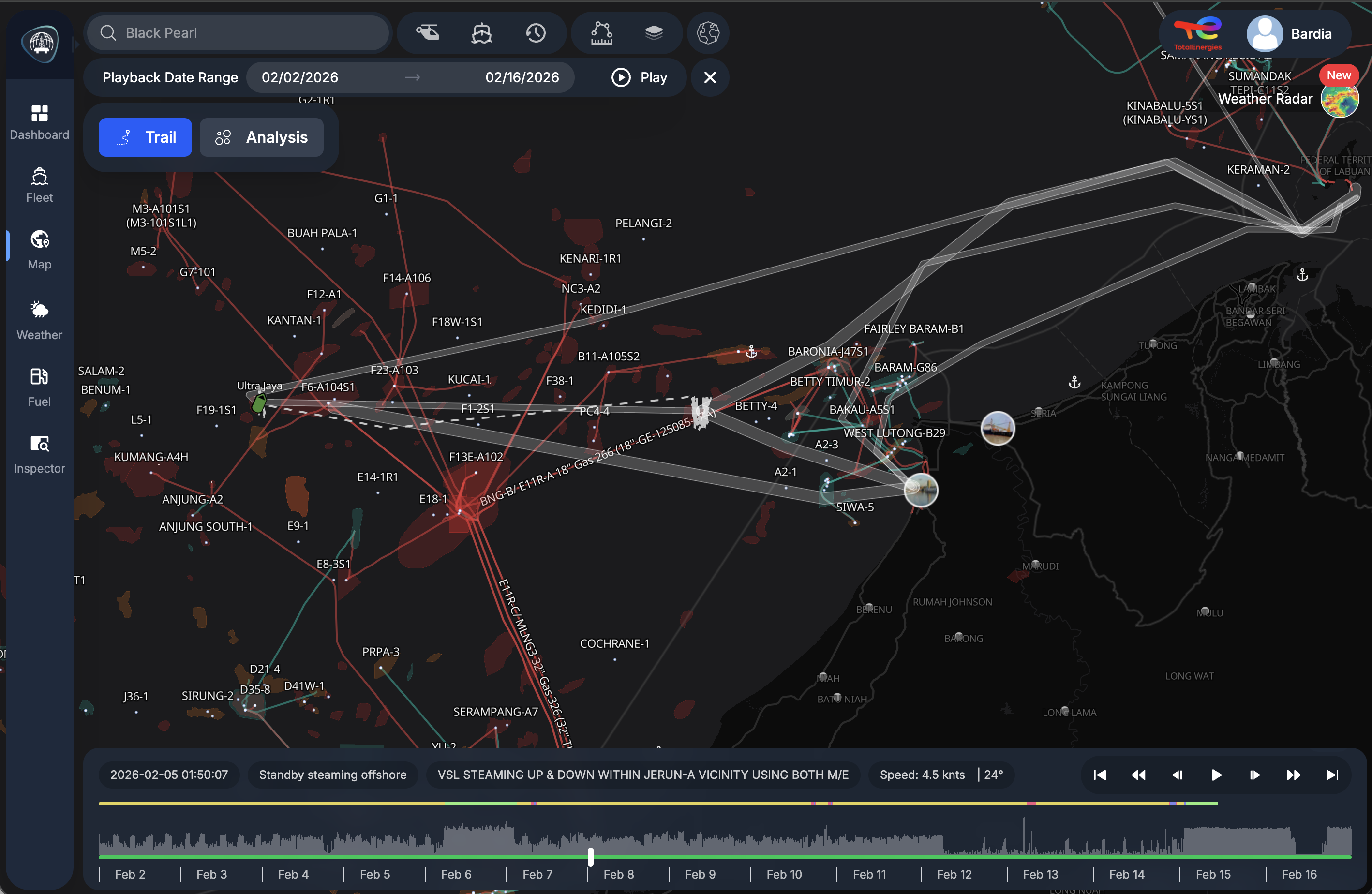
Live Vessel Tracking

Know where every vessel is, right now

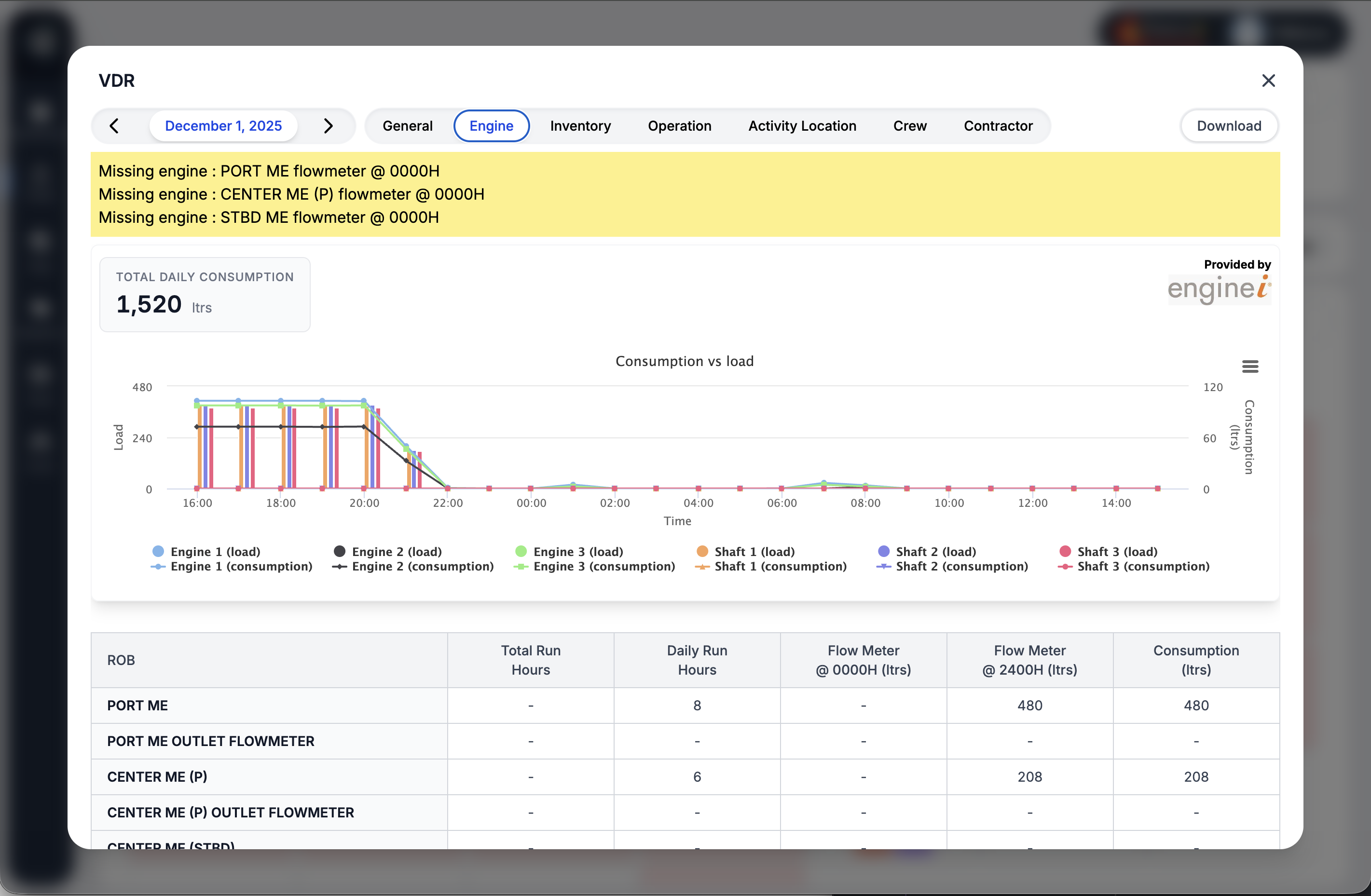
Track your entire fleet in real time with live AIS position data, vessel details, speed, heading, and status. Click any vessel to see its photo, IMO and MMSI identifiers, current route, and estimated time of arrival. The dark map interface highlights vessel trails and offshore infrastructure so you can assess your operational picture at a glance.


Fuel & Activity Analytics

AI powered fuel monitoring and activity insights

Compare fuel consumption data from multiple sources including VTS, EFMS, VDR, and GDS AI in a single dashboard. The activity summary breaks down vessel operations by status, showing transit times, standby periods, maneuvering, and cargo work alongside consumption trends. Identify inefficiencies, validate declared figures, and make data driven decisions to reduce fuel costs and emissions.

FIS AI fuel consumption comparison dashboard with activity breakdown

Enginei EFMS integration showing engine consumption and load data

Engine Fuel Monitoring

Detailed engine performance from any EFMS provider

FIS integrates with all major EFMS providers to deliver granular engine level fuel data. View consumption versus load curves for each engine and shaft generator, track flow meter readings, and monitor daily consumption totals. Missing data alerts flag gaps in reporting so nothing slips through the cracks, giving you full confidence in your fuel figures.


Voyage Playback

Replay any voyage with full timeline control

Select any date range and replay vessel movements with complete trail visualization and timeline scrubbing. The playback interface shows vessel position, speed, heading, and activity status at every point in time, overlaid on the operational map with platform locations and field boundaries. Use playback for incident investigation, voyage auditing, or verifying reported vessel activities.

FIS vessel playback interface showing historical voyage trails and timeline

Weather Integration

Live weather layers on your operational map

Overlay real time and forecast weather data directly on the FIS map. Visualize wind patterns, wave heights, currents, and storm systems alongside your fleet positions and offshore assets. Weather layers update continuously, helping marine and operations teams make informed decisions about vessel routing, crew transfers, and weather window planning.


Capabilities

Everything you need to manage your fleet

Live Minute Satellite Tracking

Real time vessel positions with speed, heading, status, and identification details.

Geofence Alerts

Define custom zones and receive instant alerts when vessels enter or exit boundaries.

AI Fuel Analytics

Compare consumption across multiple data sources with AI powered validation and anomaly detection.

Voyage Playback

Replay historical vessel movements with full timeline control for auditing and investigation.

Weather Overlays

Live and forecast weather layers including wind, waves, currents, and storm tracking.

Multi Layer Charts

Nautical charts with configurable layers for pipelines, platforms, fields, and safety zones.

Daily Activity Reports

Automated daily reports covering vessel activities, fuel sounding, crew and contractor data.

Maintenance & Deck Management

Track vessel maintenance records, scheduled services, and deck space utilization across your fleet.

Indent & Notification System

Manage vessel indent requests and get notified for planned maintenance, both onshore and offshore.

Charter Party Compliance

Verify that chartered vessels comply with charter party agreements through automated monitoring.

Ready to transform your
offshore operations?

See how GDS can deliver real-time intelligence, improve safety, and reduce costs across your fleet.